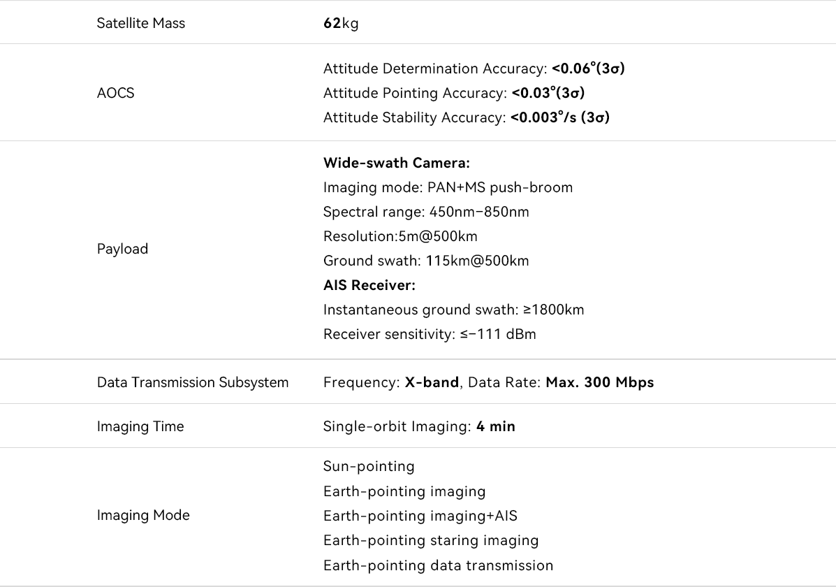
Wenchang-1/02 satellite is a space-ground integrated microsatellite developed by Beijing Minospace Technology Co., Ltd., combining both Earth remote sensing and ship AIS (Automatic Identification System) data collection capabilities. It primarily conducts remote sensing imaging of Hainan and its surrounding provincial waters, with a single-image ground swath of up to 115 kilometers. The satellite remote sensing data it acquires can provide comprehensive operational dynamic observation coverage for Hainan Island and its jurisdictional waters. These data significantly support the spatial data requirements for key sectors in Hainan, including natural resources, agriculture, forestry, marine environmental monitoring, maritime shipping, maritime emergency search and rescue, and fishery information services.
The satellite is equipped with on-board image processing capabilities, enabling direct identification of ship information from captured images through its onboard computing modules. This allows for data transmission without sending the entire image, greatly improving data transmission efficiency and enabling faster acquisition of critical information. Wenchang-1/02 satellite does not operate alone, it forms a network with the simultaneously launched Wenchang-1/01 satellite, significantly enhancing the observation efficiency and coverage capability for Hainan Island and its jurisdictional waters.
