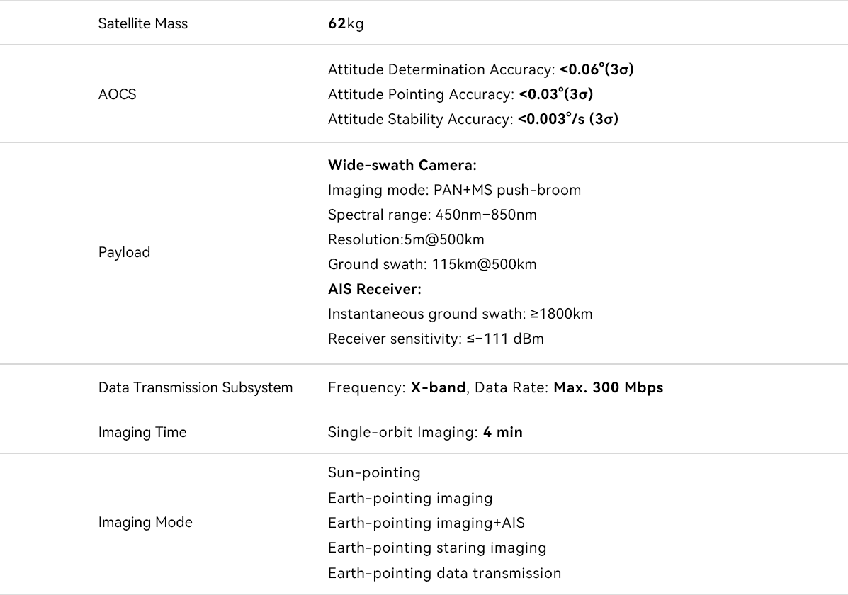
The Wenchang-1/01 satellite, developed by Beijing Minospace Technology Co., Ltd., is a space–ground integrated microsatellite combining Earth observation and ship AIS data collection. It provides remote sensing imaging of Hainan and its surrounding waters with a swath width of up to 115 km.
Its data supports a wide range of applications, including natural resources, agriculture, forestry, marine monitoring, shipping management, maritime search and rescue, and fishery services. Equipped with on-board image processing, the satellite can directly identify ship information from captured imagery and transmit only the extracted data. This greatly improves transmission efficiency and enables faster delivery of critical information.
