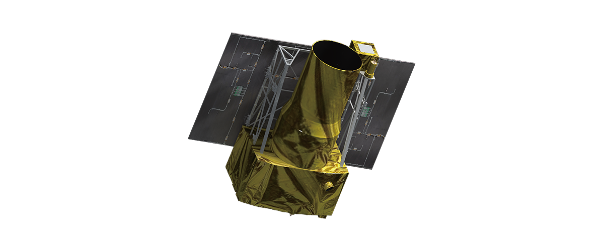
Tajing-1/03 satellite is an industry-leading lightweight high-resolution remote sensing scientific experimental satellite developed by Beijing Minospace Technology Co., Ltd., featuring high-resolution Earth observation capabilities. It can perform fusion calculations by utilizing the relationship between multi-band combined data and ground biomass data. The satellite’s application areas include forest and grassland resource monitoring and management, forest and grassland carbon sink assessment, ecosystem monitoring and service function enhancement, soil erosion monitoring and ecological restoration, as well as forest fire prevention and pest monitoring and early warning. After entering orbit and becoming operational, it continuously empowers the integrated protection and systematic management of mountains, rivers, forests, farmlands, lakes, grasslands, and deserts, particularly supporting Beijing’s construction of a city-wide forest initiative, and serving the national ecological civilization construction strategy with higher quality.